Click below for directions to the route:
- Metro Red Line
- Metrolink Van Nuys (*Special Schedule*)
- Metrolink Sylmar
- Parking & Lyft
From the Metro Red Line (North Hollywood Station) to the Panorama City Hub
(Total distance: 7.3 miles)
Ride west down Chandler Blvd. After passing Coldwater Canyon Ave, turn right onto the Orange Line Busway Bike Path. Turn right onto Woodman Ave and make a left on Roscoe Blvd until you reach Van Nuys Blvd. Total trip is 7.3 miles.

From Metrolink (Van Nuys Station) to the Panorama City Hub
(Total distance: 0.8 miles)
Metrolink will operate limited service on the Ventura County Line between Union Station and Van Nuys Station on Sunday March 6, 2016. The train will offer two “Bike Cars” on each train. The trains will operate on the following schedule:

Once you exit the train, look for CicLAvia volunteers wearing yellow t-shirts. They'll have all the information you need about return train times and the CicLAvia route. Once you exit the train, ride north on Van Nuys Blvd until you reach Roscoe Blvd.

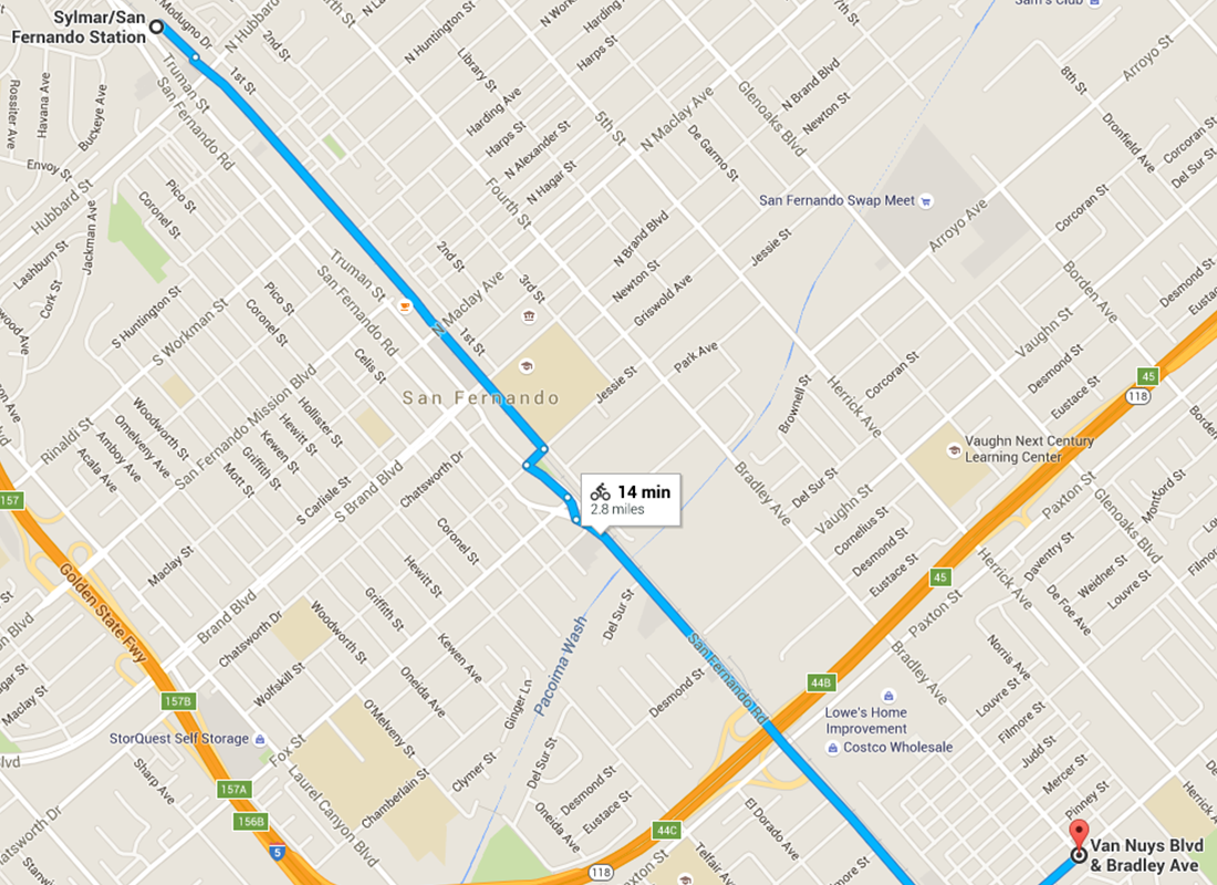
From Metrolink (Sylmar/San Fernando Station)
(Total distance: 2.8 miles)
Ride southeast on Village Way Drive and turn right on Wolfskill St. Turn left onto Truman St and continue on to Tiffany Ave. Turn left onto San Fernando Road until you reach Van Nuys Blvd.
Parking & Lyft
Street parking is recommended, as there are no large garages or lots in the area.
Don't want to drive? Take a Lyft!
As our newest partner, Lyft will donate $5 for every new rider that enters CICLAVIA as a coupon code!

